


VTT O 7 JUIN 20

mouss65
User

Length
35 km

Max alt
268 m

Uphill gradient
872 m
Km-Effort
46 km

Min alt
23 m

Downhill gradient
873 m
Boucle
Yes
Creation date :
2020-06-03 17:25:28.17
Updated on :
2020-06-03 17:57:34.826
1m
Difficulty : Easy

FREE GPS app for hiking
 SityTrail
IGN / Geographical institutes
SityTrail Plus
The world is yours!
About
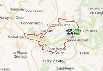
Trail Mountain bike of 35 km to be discovered at Normandy, Calvados, Le Hom. This trail is proposed by mouss65.
Positioning
Country:
France
Region :
Normandy
Department/Province :
Calvados
Municipality :
Le Hom
Location:
Thury-Harcourt
Start:(Dec)
Start:(UTM)
684196 ; 5429141 (30U) N.
Comments